NZ Farm Assurance Programme+
New Zealand’s National Farm Assurance Programmes (NZFAP). We can help you become gold certified in NZFAP+. We do it all! Gold! Silver! Blue! We're farmers first and foremost - so we understand the NZFAP+ process and requirements We'll produce built NZFAP+ report complete with maps, and a tailored environmental plan Fast turn-around and efficient Our maps are bloody good! Certified Nutrient Management Advisor

Freshwater Farm Plans
Comprehensive, fully certified farm plans (Horizons, Waikato, and Greater Wellington), detailing your farms soil and land resources, and implementing an environmental action plan. Get ahead of the curve, and get your farm plan done before the new Freshwater rules come into effect. Complete the whole farm plan with Falcon Farm Planning, all in one service! Fast turn-around and efficient! Certified under Horizons, Waikato, and Greater Wellington Regional Councils (more to come as councils get on board) High quality maps, that are useful beyond their regulatory purposes Certified Nutrient Management AdvisorUpdate – 3 September 2024Freshwater farm plan rollout to be paused. Government will pause the rollout of freshwater farm plans until improvements to the system are finalised. Once these amendments are made, farmers won’t be required to submit a freshwater farm plan for certification while changes are made to the system.

Nutrient Management Plans
Certified Nutrient Management Advisor, farm-scale nutrient management plans with practical recommendations. Produce Overseer Nutrient Management Plan Full analysis of your farm's nutrient budget Practical recommendations for nutrient management including tailored fertiliser plans if required No brainer if you want to save money on fertiliser while mitigating environmental impacts.

Drone Mapping
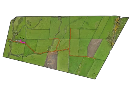
High-quality, cost-effective drone aerial imagery for FEP’s, mapping, analysis or just a damn fine map on your wall. High speed, high accuracy, high resolution! Complete most farms in a day! Terrain modelling using photogrammetry techniques Drone orthomosiac imagery and photogrammetry River, waterway, and wetland mapping for farm planning and consenting Drone photography and video

LUC & Soil Mapping
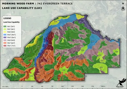
Farm-scale Land Use Capability (LUC), Land Resource Inventory (LRI) and Soil Mapping fit for any farm or orchard plan.We are highly skilled in LUC and LRI mapping, and have a proven track record of delivering high quality maps. Farms are mapped according to their land use intensisity and the purpose of the farm plan. In general, the more intensive the land use, the more detailed the mapping. Sheep & beef ~ 1:10,000 - 1:15,000 Dairy ~ 1:7,500 - 1:10,000 Intensive Arable ~ 1:5,000 - 1:7,500 Horticulture ~ <1:5,000 Regional maps are usually 1:50,000 and not fit for farm planning purposes.Land Resource Inventory (LRI) includes: Geology Soil Slope Vegetation ErosionEach component of LRI comes with it's own unique map.